


Containing the southern end of the Guadalupe Mountain range, the 86,000-acre Guadalupe Mountains National Park is surrounded by the Chihuahuan desert, in a barren, mostly isolated region of west Texas. It's close to the Carlsbad Caverns in New Mexico. In the fall, a spectacular display of fall colors rival those in New England. Varied climate zones (mountain, desert and streams) bring different wildlife and vegetation. Steep-sided canyons with lush vegetation mark the transition from desert to mountains.
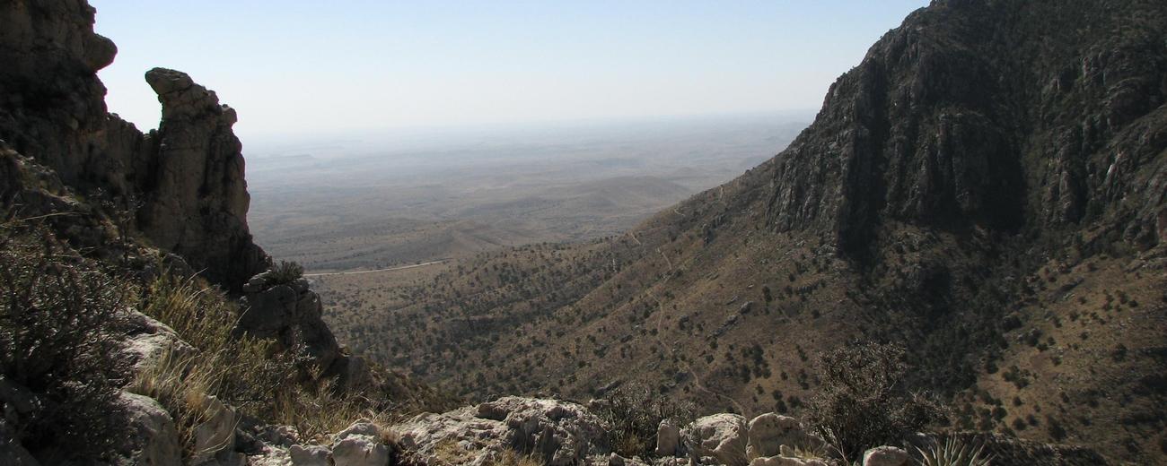
This is primarily a park for hiking, and interesting geology and photographic opportunities are along the over 80 miles of trails. Trail difficulty ranges from easy to strenuous, and these trails are often steep and rugged. They lead to Guadalupe Peak (the highest point in Texas), around the base of the massive El Capitan limestone formation, into the high country and across into McKittrick Canyon.
McKittrick Canyon is a blend of east, north and west, and the plains, desert and mountains. Deserts lead to breathtaking vistas. Juniper, velvet ash, ponderosa pine and big tooth maple offer shade. In spring, endless varieties of wildflowers carpet the ground and their fragrance fills the air. A perennial stream adds to the eclectic collection of animals, flora and fauna.
No concessions or supplies are available in the park, so bring everything you need for your visit, whether you're hiking, camping, photographing or bird and wildlife watching.
The park is located in northwest Texas near the New Mexico border. The main entrance to Guadalupe Mountains National Park is between Carlsbad, New Mexico and El Paso, Texas on US 62/160. Dog Canyon, on the park's north side, is accessed by New Mexico state road 137.