


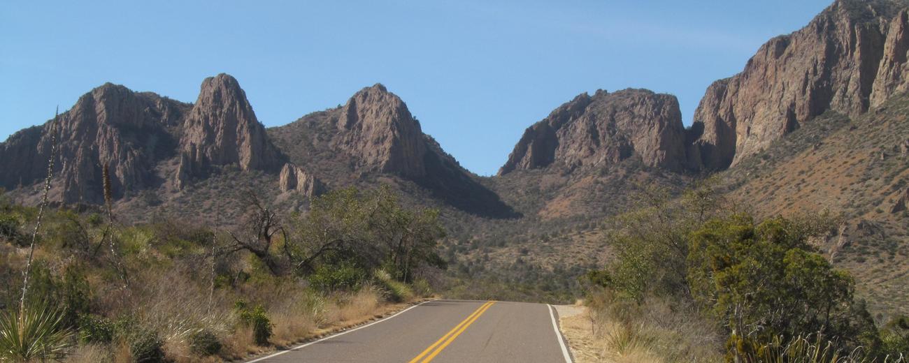


Big Bend National Park covers 801,000 acres of some of the most rugged country in west Texas. This is where the Rio Grande makes a sharp turn?the Big Bend. It is a meeting place of many things: Texas land and culture meets Mexico land and culture, desert meets mountains; north flora, fauna and birds meet south; east flora, fauna and birds meet west. Big Bend National Park encompasses rivers, massive canyons, vast desert expanses and the entire Chisos Mountain range. The rivers and mountains gather wildlife, birds and vegetation not normally found in deserts.
One hundred and eighteen miles of river form the southern park boundary and include the deep-cut canyons of Santa Elena, Mariscal and Boquillas. Guided rafting and canoeing trips are available on the Rio Grande, especially through the largest of the major canyons, Santa Elena Canyon. The Rio Conchos and Rio Grande rivers are lined with cottonwoods and willows, providing a ribbon of green across the desert expanses.
Beautiful panoramic views, colorful badlands and the solitude of the desert combine with over 100 miles of lightly used paved roads and 160 miles of backcountry dirt roads to make Big Bend National Park one of the foremost mountain biking destinations in Texas.
The 15.3-mile trail along Smoky Creek, through the Chisos foothills, is a popular route for experienced hikers. Good map-reading and route-finding skills are a must, but rewarded by access to several infrequently traveled trails and routes for exploring. Hiking is widely permitted in Big Bend, with several beginner trails as well as trails for the more experienced.
The park is located in the remote southwestern corner of Texas on the Mexico border. Highways 118 or 385 have park entrances.


